Ontario · Crown land · WMUs · Scent cone

Know the ground you’re standing on.

Bush Map reads the land under your crosshair — Crown or private, park or permit — and tells you which WMU you’re in, what’s open today, how much legal light is left and where your scent will drift, now or three days out. The land answers work even with no bars.

Free during beta · iPhone · iOS 17 or later

WMU 55A13 seasons open today
Legal light9h 08m left
Scent coneGood wind for Ridge stand
No barsLand data on your phone

The ground truth

87% of Ontario is Crown land. Knowing which part you can hunt is the hard part.

Parks, conservation reserves, game preserves, First Nations reserves and leased land carve it up. Southern Ontario is mostly private, with public hunting land scattered across county forests and conservation areas. And every one of the province’s 95 Wildlife Management Units sets its own seasons, weapons and draws.

0%
of Ontario is Crown land
0
WMUs, each with its own rules
0
season dates from the 2026 regulations
0+
county forests, conservation lands & hunt blocks

Under the crosshair

Drop the crosshair anywhere. Get a straight answer.

Tap the map, or just stand still. The card up top says what the ground is, who it belongs to and whether you can hunt it — with lot, concession, township and acreage.

01Yours to hunt.

CrosshairCrown Land — hunting permittedLot 22, Con 12 · 365 ha · McClure Twp WMU5713 open

Public Crown land, open to you with a valid licence and tags. Leased and permitted Crown land is tinted amber so it never surprises you.

Bush Map showing Crown land, hunting permitted, in McClure Township

02Ask first.

CrosshairPrivate Land — permission requiredCon 5 Pt Lot 30 · 81 ha · Haldimand Twp WMU72A11 open

Private land is hatched, with property lines and roll numbers wherever counties publish them. You’ll know whose door to knock on.

Bush Map showing private farmland in Haldimand Township, permission required

03Read the rules.

CrosshairPublic land — hunting by permitGanaraska Forest WMU7311 open

Over 1,300 county forests, conservation areas and hunt blocks from 35 sources — each with its own rules — on one map, right where southern Ontario needs it most.

Bush Map showing Ganaraska Forest, public land with hunting by permit

04Stay out.

CrosshairNo public hunting — WMU 51Algonquin Provincial Park WMU51closed

Parks, conservation reserves, game preserves, sanctuaries, federal land and First Nations reserves are flagged before you step in — and the 135 parks that do allow hunting are marked that way.

Bush Map showing Algonquin Provincial Park, no public hunting

Province to fence line

All of Ontario, on your phone. No signal needed.

Every Crown parcel, park, reserve and WMU boundary in the province ships inside the app — so the answer never waits on a cell tower. Save satellite and topo maps for your area before you head in, and the whole map works offline.

  1. 160 kmAll the WMUs around you
  2. 40 kmCrown, private and parks
  3. 10 kmYour hunting area
  4. 2.5 kmThe ridge you’ll sit
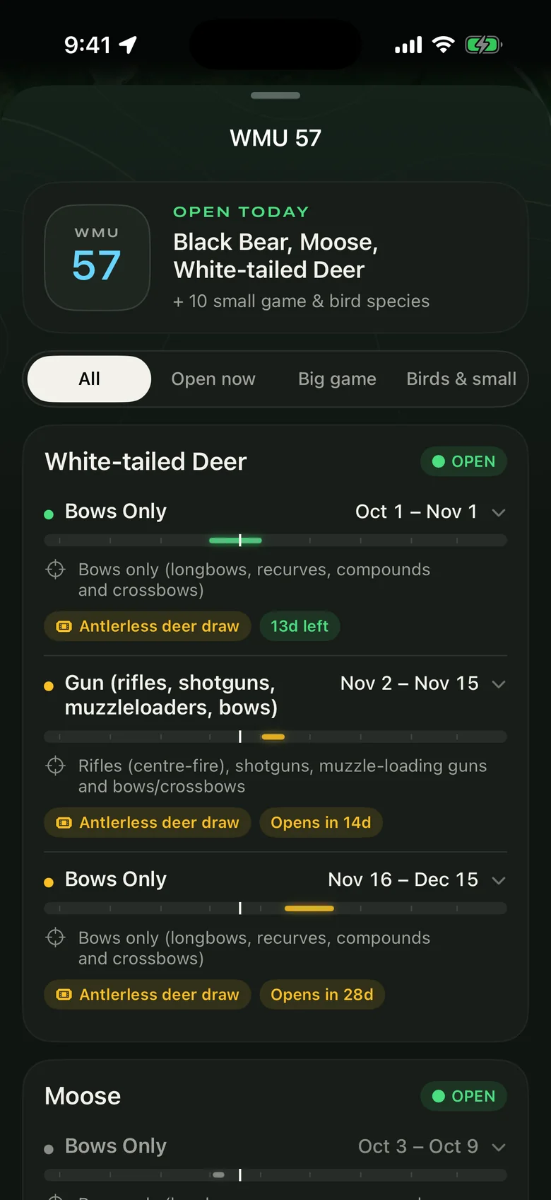
WMU 57 season sheet showing what is open today

Your WMU, decoded

What’s open today, right where you’re standing.

Tap the WMU badge for every season in your unit — species, weapon and dates, what’s open right now, antlerless and moose draws, and how to apply. Built from the 2026 Ontario Hunting Regulations Summary, and it all works offline.

WMU572026 fall seasonsSep – Dec · McClure & area
White-tailed deer
Moose draw
Black bear
Ruffed grouse
Wolf & coyote
Bows onlyGunSmall game & furbearers

Wind you can see

Watch the wind cross the land.

A live wind map streams across the land, with a 24-hour scrubber to play the day forward. Fifteen-minute forecasts for the next few hours, and measured wind from the nearest Environment Canada station.

  • 15 minforecast steps for the next three hours
  • 24 hwind map you can scrub and play
  • Measuredgusts from the nearest weather station

Move your cursor — the amber cone is your scent on this wind.

Scent cone

Know where your scent goes before you climb in.

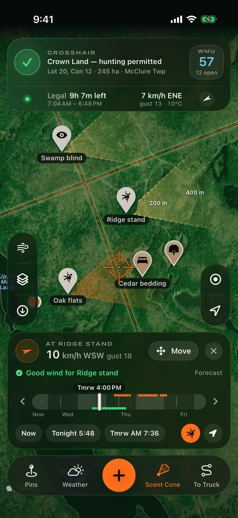
Tap Scent Cone and the map shows where your scent is drifting, with rings at 100, 200 and 400 metres. Put it on you, on any stand, or anywhere you drop it, then slide up to three days ahead to plan tonight’s sit or tomorrow morning’s.

Every stand at once.

All Stands puts a cone on every stand and blind on screen, so you can pick tonight’s sit at a glance. The one blowing over sign shows orange.

Scent cones on three stands; the cone from Oak flats is orange because it blows over Cedar bedding

Good winds per stand.

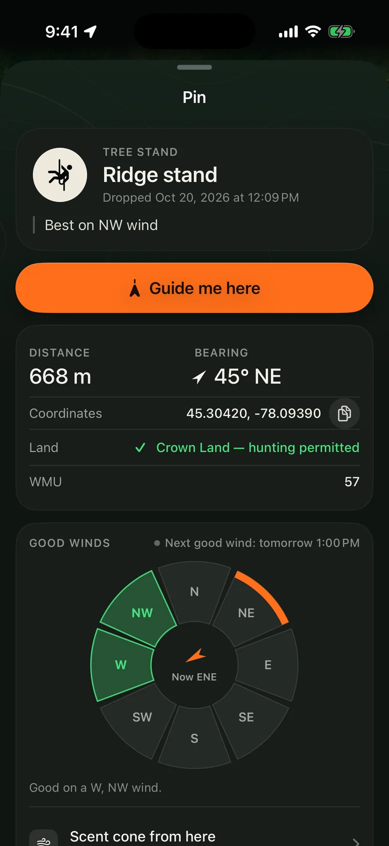
Tap the directions a stand or blind works on. Bush Map tells you when it gets one next.

Good winds for Ridge stand set to west and northwest; next good wind tomorrow at 1:00 PM

Your sits, sorted.

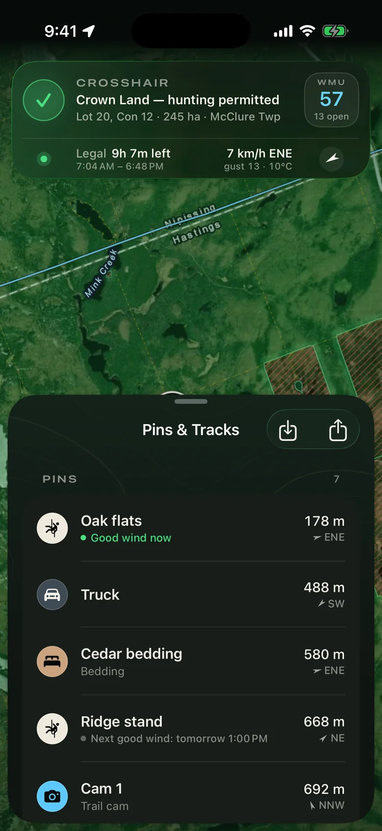
The pin list says which stands have a good wind right now, and when the rest get one.

Pin list: Oak flats has a good wind now; Ridge stand's next good wind is tomorrow at 1:00 PM
  • 100 · 200 · 400 mRings show how far your scent carries on the ground.
  • SwirlyLight or shifting wind widens the cone. Dead calm turns it into a circle.
  • MeasuredRight-now wind from the nearest Environment Canada station when one’s close.
  • No barsEach spot’s forecast is saved to your phone, so the cone keeps working on the stand.

Legal light

Legal light, to the minute.

Half an hour before sunrise to half an hour after sunset, worked out on your phone for the exact spot you’re standing. The countdown lives on the main screen; sunrise, sunset and the moon sit in the weather sheet.

Legal 11h 47m left 7:03 AM

Everything else you reach for

Built for the walk in, the sit and the drag out.

Mark the truck. Get walked back.

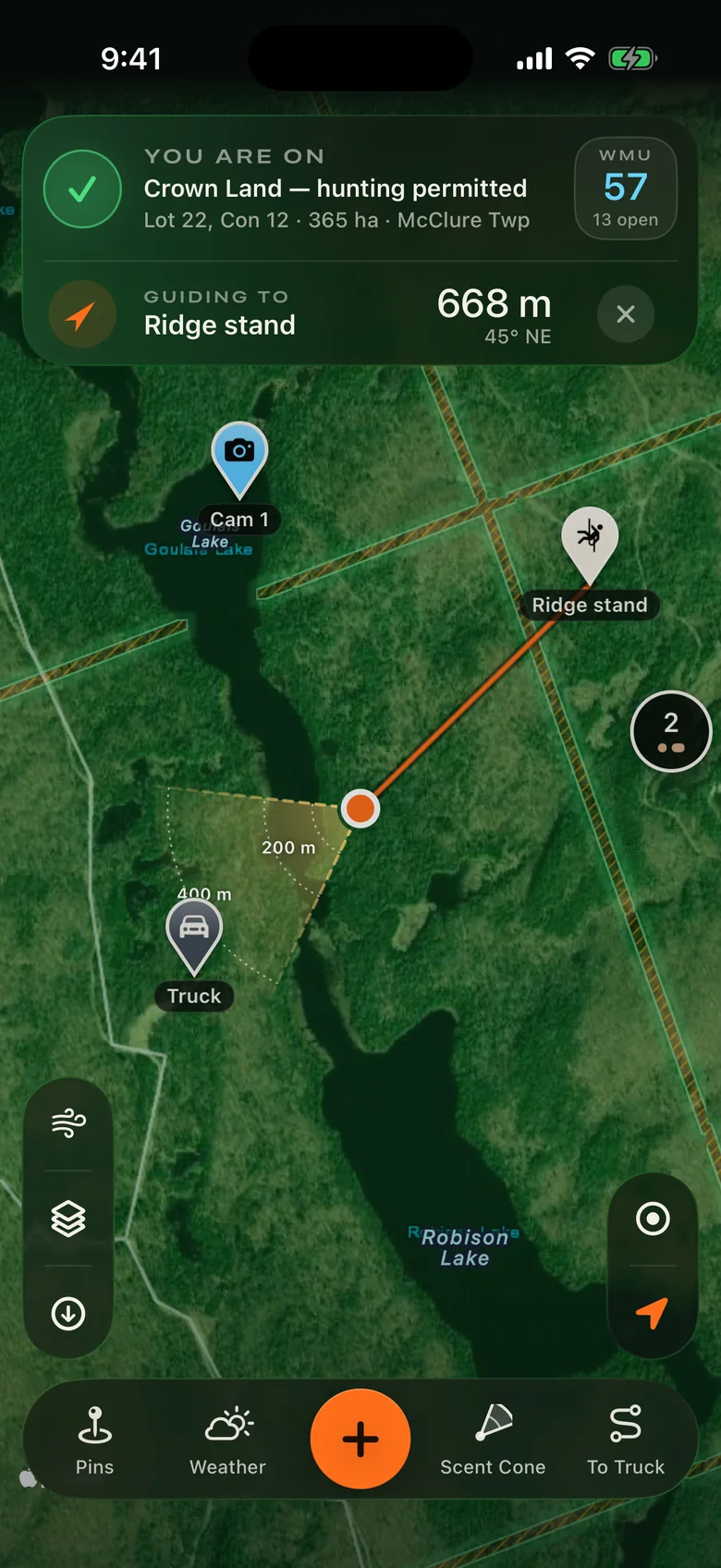
One button: tap Mark Truck when you park and it turns into To Truck, with distance, bearing and a guide line back. Works for any pin, no signal needed.

Guiding to Ridge stand, 668 metres north-east

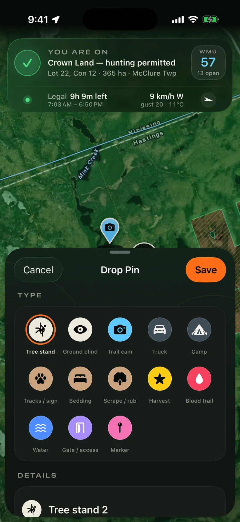
13 kinds of pins.

Tree stands, ground blinds, trail cams, scrapes, bedding, blood trails, gates and more — each with its own colour and note. Stands and blinds remember which winds they’re good on.

Drop Pin sheet with thirteen pin types

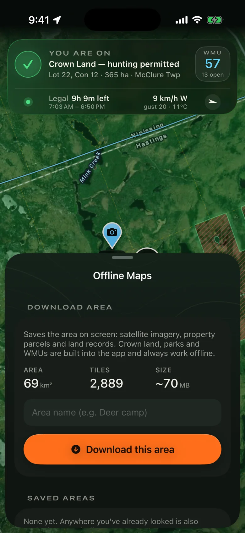
Save the map before you go.

Download satellite imagery, property parcels and land records for the area on screen.

Offline Maps sheet: 69 square kilometres, 3,058 tiles, about 74 MB

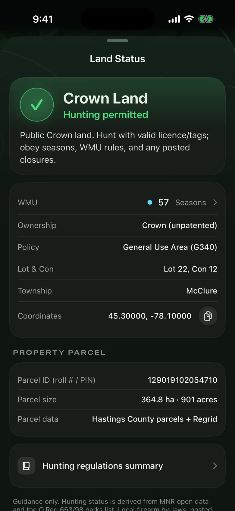
Land status, in full.

Ownership, land-use policy, lot and concession, township, and the parcel’s roll number and acreage where it’s published.

Land Status sheet for Crown land in McClure Township

Tracks

Record your route in the background. Share or import GPX.

Base maps

Satellite, topo and contours — all three save for offline.

Heading up

Tap locate twice and the map turns with you.

Bush Map app icon

Free beta · iPhone

Take it on your next sit.

Bush Map is free while it’s in beta. Join through Apple’s TestFlight and you’ll get every update as it lands.

Join the beta on TestFlight
QR code linking to the Bush Map TestFlight beta On a computer?
Scan with your iPhone camera.
  1. 1Install TestFlight from the App Store.
  2. 2Tap Join the beta and accept.
  3. 3Open Bush Map, make a free account, and go hunting.

Requires an iPhone running iOS 17 or later.